Section
What kind of site this isDrawn as an open-pit mine, dug down in benches from the surface. Federal records note the kind of operation and its status, not its depth or layout, so this is a typical example rather than a survey of this site.
Location
| State | Nevada |
| County | Mineral |
| Nearest Town | Hawthorne |
| Coordinates | 38.55130, -118.66430 |
Mine Details
| Status | Intermittent |
| Type | Surface |
| Operator | Ledcor CMI Inc. |
| Data Source | MSHA |
| Source ID | 2602928 |
This siteNearby records
Nearest Recorded Sites
| Site | Distance | Commodity | Status |
|---|---|---|---|
| Portable Crusher #2 | 2.8 mi | Ground Silica | Abandoned |
| Gregory Andalusite | 2.9 mi | Kyanite | Unknown |
| Pamlico | 3.1 mi | Gold Ore | Abandoned |
| Rodeo Grounds Pit | 3.3 mi | Sand and Gravel, Construction | Past Producer |
| Esmeralda Project/martinez-Chesco | 3.4 mi | Gold Ore | Abandoned |
| Aurora Mine | 3.5 mi | Gold | Plant |
| So. Section 35 Gravel Pit | 3.6 mi | Occurrence | |
| Navy Beach Pit | 3.6 mi | Sand and Gravel, Construction | Past Producer |
| Se Section 35 Gravel Pit | 4.7 mi | Occurrence | |
| Twilight Mine | 4.9 mi | Gold | Past Producer |
| Corey Pit | 4.9 mi | Sand and Gravel, Construction | Past Producer |
| Corey Mine | 5.0 mi | Silver | Past Producer |
What This Means
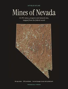

A field atlas, in print
Mines of Nevada
All 15,791 mines, prospects and mineral sites the federal record locates in Nevada, on 98 map sheets with GPS coordinates and the land manager for every one.