Section
What kind of site this isDrawn as a quarry or pit, where the rock or gravel itself is the product. The ore color stands for construction sand and gravel. Federal records note the kind of operation and its status, not its depth or layout, so this is a typical example rather than a survey of this site.
Location
| State | Colorado |
| County | Mesa |
| Nearest Town | Grand Junction |
| Coordinates | 39.07167, -108.52056 |
Commodities
| Primary | Construction Sand and Gravel |
Mine Details
| Status | Abandoned |
| Type | Surface |
| Operator | Grand Junction Concrete Pipe Co. |
| Data Source | MSHA |
| Source ID | 0504824 |
Nearest Recorded Sites
| Site | Distance | Commodity | Status |
|---|---|---|---|
| Crusher 1 | 0.0 mi | Construction Sand and Gravel | Intermittent |
| Washplant 1 | 0.0 mi | Construction Sand and Gravel | Intermittent |
| Suncore West Colorado | 1.0 mi | Construction Sand and Gravel | Active |
| Whitewater #71 | 1.0 mi | Construction Sand and Gravel | Intermittent |
| Unknown near Orchard Mesa, CO | 1.4 mi | Sand and Gravel, Construction | Producer |
| Gravel Pit | 1.6 mi | Sand and Gravel, Construction | Unknown |
| Unnamed near Orchard Mesa, CO | 1.6 mi | Sand and Gravel, Construction | Unknown |
| Unknown near Orchard Mesa, CO | 1.6 mi | Gypsum-Anhydrite | Occurrence |
| Crusher #6 | 1.7 mi | Construction Sand and Gravel | Intermittent |
| Unnamed Mine near Grand Junction, CO | 1.9 mi | Clay | Unknown |
| Unknown near Grand Junction, CO | 1.9 mi | Fire Clay (Refractory) | Occurrence |
| Corn Construction Co 30 Road Pit | 2.0 mi | Sand and Gravel, Construction | Unknown |
What This Means
This mine is listed as abandoned or sealed in federal records. Abandoned mines can pose safety and environmental risks, including unstable ground, toxic gas accumulation, flooded shafts, and potential groundwater contamination from heavy metals or acid mine drainage. Never enter an abandoned mine. If you live near this site, consider checking with your state environmental agency about any ongoing remediation or monitoring programs.
 Page 200 · Mines of Colorado
In the printed atlas
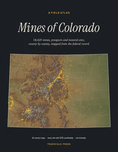
This site is on page 200 of Mines of Colorado
It is plotted on the Mesa County map, ringed in the crop of that page. Its gazetteer line (name, commodities, status, working type and GPS coordinates) is on page 205.