Section
What kind of site this isDrawn as a small mine; the records don't say whether it was worked from the surface or underground. The ore color stands for geothermal. Federal records note the kind of operation and its status, not its depth or layout, so this is a typical example rather than a survey of this site.
Location
| State | Idaho |
| County | Caribou |
| Coordinates | 42.77882, -111.53581 |
Commodities
| Primary | Geothermal |
Mine Details
| Status | Unknown |
| Data Source | USGS MRDS |
| Source ID | 10265397 |
This siteNearby records
Nearest Recorded Sites
| Site | Distance | Commodity | Status |
|---|---|---|---|
| Blackfoot Bridge Proposed Mine | 1.0 mi | Phosphorus-Phosphates | Prospect |
| Aspen Range North | 1.0 mi | Phosphorus-Phosphates | Occurrence |
| Trail Creek | 1.9 mi | Phosphorus-Phosphates | Unknown |
| West Bank Blackfoot River | 2.5 mi | Pumice | Unknown |
| Nu-West Phos-Acid Plant | 2.7 mi | Phosphorus-Phosphates | Plant |
| Rasmussen Valley Mine | 2.8 mi | Phosphate Rock | Abandoned |
| J.r. Simplot Washing/calcine Plant | 3.4 mi | Phosphorus-Phosphates | Past Producer |
| Conda Mine | 3.6 mi | Phosphorus-Phosphates | Past Producer |
| Bfb & Ballard Mines | 3.6 mi | Phosphate Rock | Active |
| Ev, Ballard & Blackfoot Bridge Mines | 3.6 mi | Phosphate Rock | Abandoned |
| Caldwell Canyon Mine | 4.2 mi | Construction Sand and Gravel | Intermittent |
| Rasmussen Ranch | 4.2 mi | Misc. Metal Ore NEC | Abandoned |
What This Means
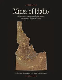

A field atlas, in print
Mines of Idaho
All 10,386 mines, prospects and mineral sites the federal record locates in Idaho, on 76 map sheets with GPS coordinates and the land manager for every one.